Top stories


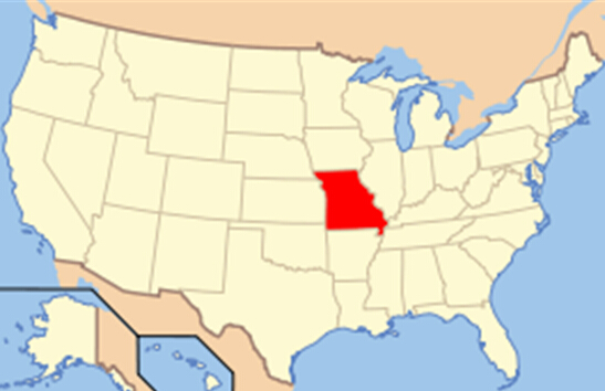
Missouri is a U.S. state located in the Midwestern United States. Missouri is the 21st most extensive and the 18th most populous of the 50 United States. Missouri comprises 114 counties and the independent city of St. Louis.
The four largest urban areas are St. Louis, Kansas City, Springfield, and Columbia. Missouri's capital is Jefferson City. The land that is now Missouri was acquired from France as part of the Louisiana Purchase and became known as the Missouri Territory. Part of the Territory was admitted into the union as the 24th state on August 10, 1821.
Missouri's geography is highly varied. The northern part of the state lies in dissected till plains while the southern part lies in the Ozark Mountains (a dissected plateau), with the Missouri River dividing the two. The state lies at the intersection of the three greatest rivers of North America, with the confluence of the Mississippi and Missouri Rivers near St. Louis, and the confluence of the Ohio River with the Mississippi north of the Bootheel. The starting points for the Pony Express, Santa Fe Trail, and Oregon Trail were all located in Missouri. The mean center of United States population as of the 2010 Census is at the town of Plato in Texas County.
Geography
Missouri borders eight different states, as does its neighbor, Tennessee. No state in the U.S. touches more than eight states. Missouri is bounded on the north by Iowa; on the east, across the Mississippi River, by Illinois, Kentucky, and Tennessee; on the south by Arkansas; and on the west by Oklahoma, Kansas, and Nebraska (the last across the Missouri River). The two largest Missouri rivers are the Mississippi, which defines the eastern boundary of the state, and the Missouri River, which flows from west to east through the state, essentially connecting the two largest metros, Kansas City and St. Louis.
Although today the state is usually considered part of the Midwest, historically Missouri was considered by many to be a Southern state, chiefly because of the settlement of migrants from the South and its status as a slave state before the Civil War. The counties that made up "Little Dixie" were those along the Missouri River in the center of the state, settled by Southern migrants who held the greatest concentration of slaves.
In 2005, Missouri received 16,695,000 visitors to its national parks and other recreational areas totaling 202,000 acres (820 km2), giving it $7.41 million in annual revenues, 26.6% of its operating expenditures.
Missouri is called the "Show Me State," because its people have a reputation for believing only what they see. Its name is an Algonquin Indian term meaning "river of the big canoes." Originally home to a number of Indian tribes, the state entered the Union in 1821. Today, more than half the population lives in Missouri's two major cities--Kansas City and St. Louis. The dogwood is the state tree, the bluebird is the state bird and the capital is Jefferson City.