Top stories


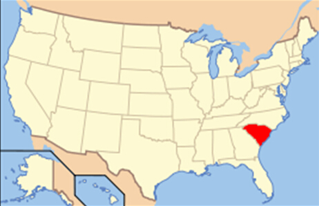
South Carolina is a state in the Southeastern United States. It is bordered to the north by North Carolina; to the south and west by Georgia, located across the Savannah River; and to the east by the Atlantic Ocean. Originally part of the Province of Carolina, the Province of South Carolina was the first of the 13 colonies that declared independence from the British Crown during the American Revolution.
South Carolina was the first state to ratify the Articles of Confederation, and the 8th state to ratify the US Constitution on May 23, 1788. South Carolina later became the first state to vote to secede from the Union which it did on December 20, 1860. It was readmitted to the United States on June 25, 1868.
South Carolina is the 40th most extensive and the 24th most populous of the 50 United States. South Carolina comprises 46 counties. The capital and largest city of the state is Columbia, while the largest MSA is Greenville.
Settled by the English in 1670, South Carolina was based on a plantation culture with an aristocratic, wealthy society that was dependent on black slave labor. One of the original 13 colonies, South Carolina was first formed in 1729 when the Carolina colony was divided in two to form North and South Carolina. The attack on Fort Sumter in the Charleston harbor launched the Civil War. After the war, the structure of the state changed. Today, South Carolina is a growing research center and banking state. It is fitting that the state tree of the "Palmetto State" is the cabbage palmetto, which also appears on the state flag. The flower is the yellow jessamine, and the capital is Columbia.
Geography
South Carolina is composed of five geographic areas, or physiographic provinces, whose boundaries roughly parallel the Atlantic coastline. In the southeast part of the state is the Coastal Plain, which can be divided into the Outer and Inner Coastal Plains. From north to south the coast is divided into three separate areas, the Grand Strand, the Santee River Delta, and the Sea Islands. Further inland are the Sandhills, ancient dunes from what used to be South Carolina's coast millions of years ago. The Fall Line, which marks the limit of navigable rivers, runs along the boundary of the Sandhills and the Piedmont, which has rolling hills and clay soils. In the northwest corner of the state are the Blue Ridge Mountains, the smallest geographical region in the state.
The state's coastline contains many salt marshes and estuaries, as well as natural ports such as Georgetown and Charleston. An unusual feature of the coastal plain is a large number of Carolina bays, the origins of which are uncertain. The bays tend to be oval, lining up in a northwest to southeast orientation. The terrain is flat and the soil is composed entirely of recent sediments such as sand, silt, and clay. Areas with better drainage make excellent farmland, though some land is swampy. The natural areas of the coastal plain are part of the Middle Atlantic coastal forestsecoregion.
Just west of the coastal plain is the Sandhills region. The Sandhills are remnants of coastal dunes from a time when the land was sunken or the oceans were higher.
The Piedmont (Upstate) region contains the roots of an ancient, eroded mountain chain. It is generally hilly, with thin, stony clay soils, and contains few areas suitable for farming. Much of the Piedmont was once farmed, with little success. It is now reforested. These forests are part of the Southeastern mixed forestsecoregion. At the southeastern edge of the Piedmont is the fall line, where rivers drop to the coastal plain. The fall line was an important early source of water power. Mills built to harness this resource encouraged the growth of several cities, including the capital, Columbia. The larger rivers are navigable up to the fall line, providing a trade route for mill towns.
The northwestern part of the Piedmont is also known as the Foothills. The Cherokee Parkway is a scenic driving route through this area. This is where Table Rock State Park is located.
Highest in elevation is the Blue Ridge Region, containing an escarpment of the Blue Ridge Mountains, which continue into North Carolina and Georgia, as part of the southern Appalachian chain. Sassafras Mountain, South Carolina's highest point at 3,560 feet (1,090 m) is located in this area. Also located in this area is Caesars Head State Park. The environment here is that of the Appalachian-Blue Ridge forestsecoregion. The Chattooga River, located on the border between South Carolina and Georgia, is a favorite whitewater rafting destination.