Top stories


Death Valley is a desert valley located in Eastern California. Situated within the Mojave Desert, it is the lowest and driest area in North America.
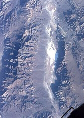
Death Valley's Badwater Basin is the point of the lowest elevation in North America at 282 feet (86 m) below sea level. This point is 84.6 miles (136.2 km) east-southeast of Mount Whitney, the highest point in the contiguous United States with an elevation of 14,505 feet (4,421 m).[2] Death Valley's Furnace Creek holds the record for the highest reliably reported air temperature in the world, 134 °F (56.7 °C) on July 10, 1913.[3][4]
Located near the border of California and Nevada, in the Great Basin, east of the Sierra Nevada mountains, Death Valley constitutes much of Death Valley National Park and is the principal feature of the Mojave and Colorado Deserts Biosphere Reserve. It is located mostly in Inyo County, California. It runs from north to south between the Amargosa Range on the east and the Panamint Range on the west; the Sylvania Mountains and the Owlshead Mountains form its northern and southern boundaries, respectively. It has an area of about 3,000 sq mi (7,800 km2).[5] The highest point in Death Valley itself is Telescope Peak in the Panamint Range, which has an elevation of 11,043 feet (3,366 m).