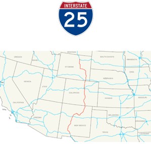
Interstate 25 (I-25) is an Interstate Highway in the western United States. It is primarily a north–south highway. I-25 stretches from Interstate 10 at Las Cruces, New Mexico, (approximately 25 miles (40 km) north of El Paso, Texas), to Interstate 90 in Buffalo, Wyoming, (approximately 60 miles (97 km) south of the Montana/Wyoming border).[2]
Interstate 25 is the main north–south expressway through Wyoming, Colorado, and New Mexico. From north to south, it passes through or near Casper, Wyoming; Cheyenne, Wyoming; Fort Collins, Colorado; Denver, Colorado; Colorado Springs, Colorado; Pueblo, Colorado; Raton, New Mexico; Las Vegas, New Mexico; Santa Fe, New Mexico; Albuquerque, New Mexico; Socorro, New Mexico; Truth or Consequences, New Mexico and Las Cruces, New Mexico. The I-25 corridor is mainly rural, especially in Wyoming, excluding the Albuquerque, Pueblo, Colorado Springs, and the Denver areas. The part of I-25 in Colorado passes just east of the Front Range of the Rocky Mountains. That stretch was recently involved in a large-scale renovation named the T-REX[3] (TRansportationEXpansion) in Denver, and the COSMIX (Colorado Springs Metropolitan Interstate Expansion). These projects and others in New Mexico were necessitated because these stretches of I-25 were inadequately designed and constructed originally (the pavement was deteriorating rapidly), and also because urban areas like Denver, Colorado Springs, and Albuquerque had tripled and quadrupled in population much earlier than anyone had anticipated back in the 1950s and 1960s. Major highway work for the T-REX project ended on August 22, 2006. The COSMIX project was completed in December 2007. Several other smaller improvement projects for I-25 are still ongoing within Colorado and New Mexico.
New Mexico
Interstate 25 begins at Interstate 10's exit 144 in Las Cruces, just south of the New Mexico State University campus. I-25 is concurrent with U.S. Route 85 at this point, and carries this concurrency for the entire length of its run in New Mexico. Immediately, three exits provide access to the city, including one for U.S. Route 70. After this, there are no major cities along the corridor until Albuquerque. However, when I-25 reaches Truth or Consequences, it is parallel to Elephant Butte Lake State Park.
As I-25 nears Albuquerque, it has interchanges with highways such as U.S. Route 380 and a concurrency with U.S. 60. Further north, State Road 6, former U.S. Route 66, meets up with I-25 in Los Lunas. Through Albuquerque, there are frequent exits to city streets, and a major interchange with Interstate 40. Named the Big I, it was given an honorable mention by the United States Department of Transportation and the Federal Highway Administration for excellence in urban highway design in 2002.
Leaving Albuquerque to the north, I-25 curves to the northeast as it approaches Santa Fe. Continuing 'northbound' at Santa Fe, I-25 heads southeasterly for approximately 45 miles (72 km) and turns north again at Blanchard toward Las Vegas. The highway maintains a north and northeast orientation as it leaves New Mexico traversing Raton Pass and enters Colorado. For its entire length in the state, I-25 shares its alignment with US-85, although US-85 is unsigned.
History
The section between Romeroville, N.M., and Los Lunas, New Mexico, closely follows the original alignment of U.S. Highway 66, which was later shortened and realigned to run due west from Santa Rosa. Now, that has been replaced with Interstate 40.