Top stories


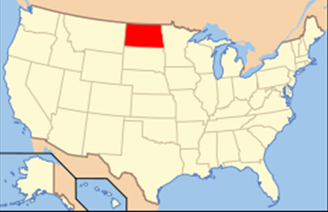
North Dakotais the 39th state of the United States, having been admitted to the union on November 2, 1889.
It is located in the Upper Midwestern region of the United States, bordered by the Canadianprovinces of Saskatchewan and Manitoba to the north, the states of Minnesota to the east, South Dakota to the south, and Montana to the west. The state capitol is located in Bismarck and the largest city is Fargo. Currently, North Dakota is the 19th most extensive but the 3rd least populous and the 4th least densely populated of the 50 United States.
The primary public universities are located in Grand Forks and Fargo. The U.S. Air Force operates air bases near Minot and Grand Forks.
North Dakota has weathered the Great Recession with a boom in natural resources, particularly a boom in oil extraction from the Bakken formation, which lies beneath the western part of the state. The development has driven strong job and population growth, and low unemployment.
Geography
North Dakota is located in the U.S. region known as the Great Plains. The state shares the Red River of the North with Minnesota on the east; South Dakota is to the south, Montana is to the west, and the Canadian provinces of Saskatchewan and Manitoba are north. North Dakota is situated near the middle of North America with a stone marker in Rugby, North Dakota marking the "Geographic Center of the North American Continent". With an area of 70,762 square miles (183,273 km2), North Dakota is the 19th largest state.
The western half of the state consists of the hilly Great Plains, and the northern part of the Badlands to the west of the Missouri River. The state's high point, White Butte at 3,506 feet (1,069 m), and Theodore Roosevelt National Park are located in the Badlands. The region is abundant in fossil fuels including natural gas, crude oil and lignite coal. The Missouri River forms Lake Sakakawea, the third largest man-made lake in the United States, behind the Garrison Dam.
The central region of the state is divided into the Drift Prairie and the Missouri Plateau. The eastern part of the state consists of the flat Red River Valley, the bottom of glacial Lake Agassiz. Its fertile soil, drained by the meandering Red River flowing northward into Lake Winnipeg, supports a large agriculture industry. Devils Lake, the largest natural lake in the state, is also found in the east.
Eastern North Dakota is overall flat, however, there are significant hills and buttes in western North Dakota. Most of the state is covered in grassland; crops cover most of eastern North Dakota but become increasingly sparse in the center and farther west. Natural trees in North Dakota are found usually where there is good drainage such as the ravines and valley near the Pembina Gorge and Killdeer Mountains, the Turtle Mountains, the hills around Devil's Lake, in the dunes area of McHenry County in central North Dakota, and along the Sheyenne Valley slopes and the Sheyenne delta. This diverse terrain supports nearly 2,000 species of plants.
Both rural and agricultural, with grain farms and cattle ranches, North Dakota gets its name from the Dakota division of the Sioux Indians who lived on the plains before the Europeans arrived. "Dakota" means "friend." French-Canadian soldier and fur trader Pierre Gaultier de Varennes was the first known white explorer to visit the home of the Dakota in 1738. North Dakota was one of the last areas of the frontier to be settled by non-Native Americans, and even today, it's not a highly populated state. North Dakota, whose capital is Bismarck, joined the Union in 1889 as the 39th state. Appropriately, the state flower is the wild prairie rose.